Cookies
This website uses cookies. Find out more here.
If you continue using our website, we'll assume that you are happy to receive cookies.
This website uses cookies. Find out more here.
If you continue using our website, we'll assume that you are happy to receive cookies.
This website uses cookies. Find out more here. If you continue using our website, we'll assume that you are happy to receive cookies.
This website uses cookies.
Find out more here.
This website uses cookies.
Find out more here.
This website uses cookies. Find out more here.
This website uses cookies. Find out more .
This website uses cookies. More .
CTC Cambridge
Route issueNarrow Unsurfaced

Cam towpath between Baits Bite lock and Waterbeach

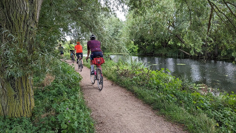
This section of the Cam towpath is narrow and has an uneven surface. Surface is generally dry but can get muddy at the Waterbeach end.

There is a tricky sharp corner where the path turns inland at the Clayhithe bridge.

×

Download route

Download GPX track
  • Useful for any GPS unit. Contains no cuesheet entries, only track information (breadcrumb trail).
Download TCX course
  • Compatible with most modern GPS units. Provides custom cue entries, but may consume more space than FIT.
Download FIT course
  • FIT is the best format for turn-by-turn directions on modern Garmin Edge Devices.
×

The photo is looking north about 500m after Bates Bite lock.

We welcome corrections and updates.